Camera Alignment
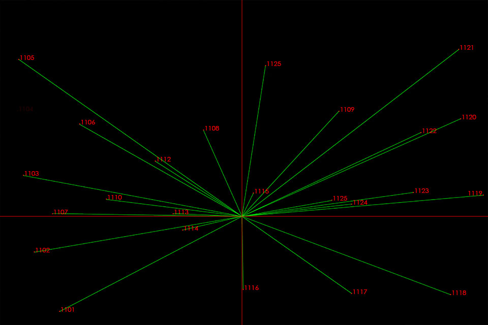
The camera coordinate and orientation values are calculated using a process that operates independently of 3ds Max. This not only creates the all the alignment data necessary to set up the 3ds Max cameras but also quantifies the accuracy of the alignment and identifies any problems within the survey or photograph so they can be fixed prior to their creation in the next stage. The standard working tolerance is that no rendered survey point can be offset from it's target on the image by more than 2 pixels at the native image capture size.
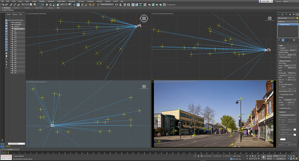
3ds Max camera setup
The alignment data is entered into a spreadsheet and a fully automated script sets up the cameras and renders out the survey points to verify the camera match. In this process there are no manual adjustments to the values as per a conventional camera matching procedure and any problems identified by mismatched rendered survey points would result in the process being checked again in the previous resection stage. In this way the process has two fully independent stages of verification to ensure the end user can start rendering with the utmost confidence in the alignment.
Alignment to aerial or offshore images
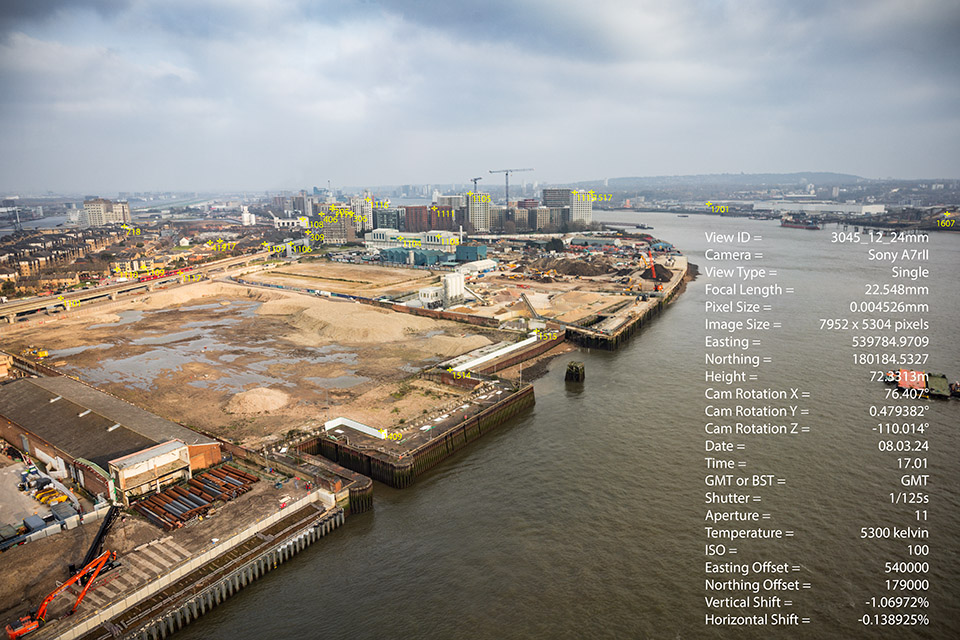
Pictures taken from aircraft, drones or boats are sometimes required to be verified and with traditional methods where even an rough camera coordinate is not available this can be a long and time consuming process which may ultimately prove impossible and therefore risky to commission. This is no problem for this system as it does not require the photographer to mark the camera position nor have the camera level. The below fully aligned image was taken hand held and through a plastic window from a cable car over the Thames.
Customer Deliverables
The result of these processes is a package containing the following;
Layered tiff file consisting of the base photograph, survey marked coordinates, rendered survey points and image data
Photographic record of the camera in it's position
3Ds Max file with aligned camera and survey coordinates to enable to end user to render out their own survey coordinates as per their existing methodology if they require.
A text file containing all the data used for each individual camera and a spreadsheet for all data in the job.
Original survey data in CSV and DXF formats
© Arcminute Ltd Registered in England and Wales No 7544732